
Everest Base Camp Trek Map
Introduction
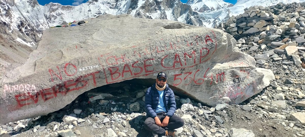
The Everest Base Camp Trek is one of the most iconic Himalayan adventures in the world. It takes trekkers deep into the Khumbu region of Nepal, through Sherpa villages, Buddhist monasteries, suspension bridges, alpine forests, and dramatic mountain landscapes. The trail eventually reaches Everest Base Camp at approximately 5,364 meters (17,598 feet), beneath the world’s highest mountain, Mount Everest.
Understanding the Everest Base Camp trek map, elevation, and duration is essential before starting the journey. The trek is not simply a long walk to a single destination. It is a gradual journey from the lower hills to a high-altitude glacial environment, where proper acclimatization is one of the most important parts of the itinerary.
A standard EBC trek usually takes around 12–14 days from Lukla to Lukla, although the total duration can be longer when including travel between Kathmandu and Lukla, acclimatization days, weather delays, or additional destinations such as Gokyo Lakes.
The classic route begins at Lukla, follows the Dudh Koshi Valley toward Namche Bazaar, and gradually climbs through Tengboche, Dingboche, Lobuche, and Gorak Shep before reaching Everest Base Camp. Many trekkers also climb Kala Patthar, one of the best viewpoints for panoramic views of Everest and surrounding Himalayan peaks.
Here, explains the Everest Base Camp trek route map, day-by-day itinerary, elevation profile, walking distance, and recommended duration so you can understand what to expect before beginning your Himalayan adventure.
Map Overview
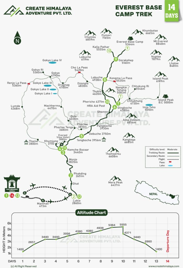
The Everest Base Camp trek map follows a well-established route through Sagarmatha National Park and the traditional Sherpa settlements of the Khumbu Valley.
The classic trekking route can be summarized as:
Lukla → Phakding → Namche Bazaar → Tengboche → Dingboche → Lobuche → Gorak Shep → Everest Base Camp → Gorak Shep → Pheriche/Dingboche → Namche Bazaar → Lukla
The trail starts at Lukla, situated at approximately 2,860 meters, and initially descends toward the Dudh Koshi River before following the river valley toward Phakding and Monjo.
From Monjo, trekkers enter Sagarmatha National Park. The trail then continues through forests and traditional villages until reaching Namche Bazaar, the commercial and cultural center of the Khumbu region.
After Namche, the route becomes progressively higher. Trekkers pass through Tengboche, famous for its monastery and spectacular mountain scenery, before entering the more open alpine landscape around Dingboche.
The route then continues toward Lobuche and Gorak Shep. From Gorak Shep, trekkers make the final journey to Everest Base Camp. The trail crosses rugged terrain near the Khumbu Glacier before reaching the famous base camp area.
The return journey generally follows the same broad route, although the itinerary can be modified according to weather, fitness, acclimatization, and transportation arrangements.
Major points on the EBC trek map
| Trekking Point | Approx. Elevation |
|---|---|
| Lukla | 2,860 m |
| Phakding | 2,651 m |
| Namche Bazaar | 3,440 m |
| Tengboche | 3,860 m |
| Dingboche | 4,410 m |
| Lobuche | 4,940 m |
| Gorak Shep | 5,164 m |
| Everest Base Camp | 5,364 m |
| Kala Patthar | 5,54 |
Elevations can vary slightly between maps, GPS devices, and published trekking references.
The map is more than a navigation tool. It helps trekkers understand how quickly the trail gains altitude and why acclimatization days are included in a responsible Everest Base Camp itinerary.
Day-by-Day EBC Trek Route
A typical Everest Base Camp trek itinerary takes about two weeks when travel arrangements and acclimatization are included. The exact schedule can vary depending on the trekking company, weather, flight conditions, and individual walking pace.
Day 1: Fly to Lukla and Trek to Phakding
The adventure usually begins with a flight from Kathmandu or, during some periods, from Ramechhap/Manthali to Lukla.
After landing at Lukla, the trek begins with a relatively short walk toward Phakding. The trail passes through small settlements, green hills, and sections of pine and rhododendron forest.
- Lukla: 2,860 m
- Phakding: 2,651 m
Approximate walking time: 3–4 hours
Day 2: Phakding to Namche Bazaar
The trail follows the Dudh Koshi River toward Monjo and the entrance to Sagarmatha National Park. Several suspension bridges add excitement to the journey.
After crossing the Hillary Suspension Bridge, the trail climbs steeply toward Namche Bazaar.
- Namche Bazaar: 3,440 m
- Approximate walking time: 5–7 hours
This is one of the first significant elevation gains of the trek.
Day 3: Acclimatization at Namche Bazaar
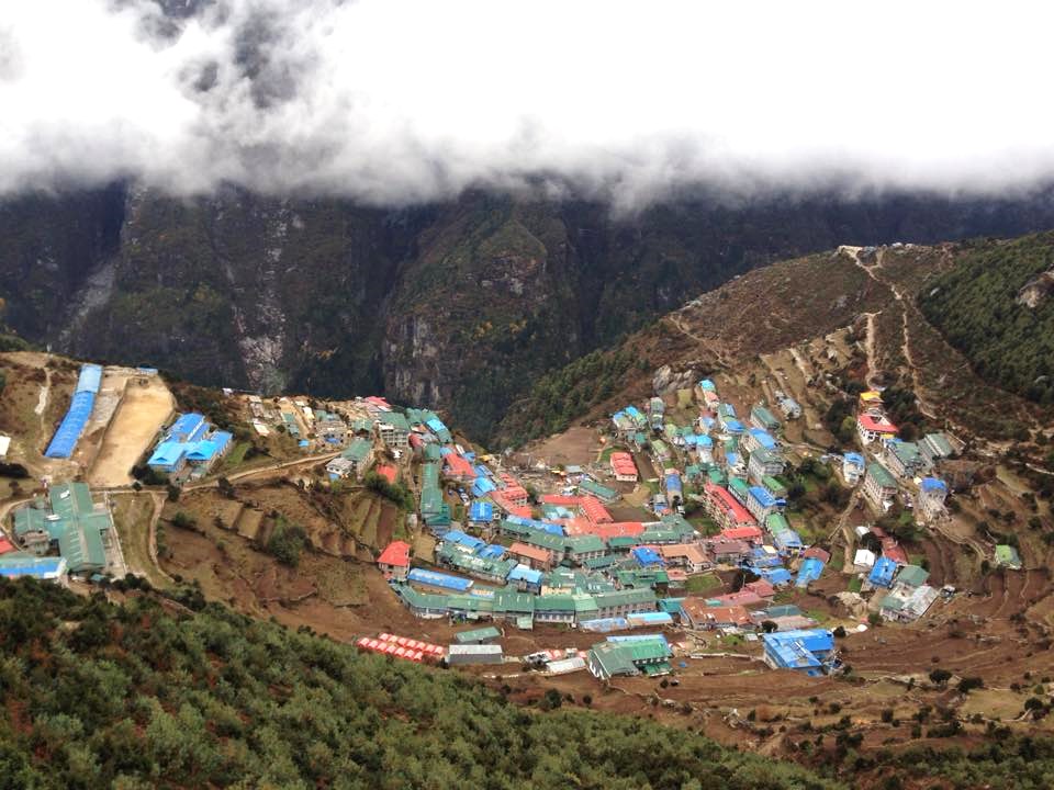
Namche is an important acclimatization stop. Rather than simply resting inside the lodge, trekkers commonly take a short hike to higher elevations before returning to Namche.
Possible viewpoints include the Everest View Hotel area and nearby hills overlooking Everest, Ama Dablam, Lhotse, and other Himalayan peaks.
The principle is simple: climb higher during the day and sleep lower at night.
Day 4: Namche Bazaar to Tengboche
The trail gradually leaves Namche and follows a scenic ridge with spectacular Himalayan views. After descending toward the river, trekkers climb again toward Tengboche.
- Tengboche: approximately 3,860 m
- Approximate walking time: 5–6 hours
Day 5: Tengboche to Dingboche
The route descends through rhododendron and conifer forests before crossing the Imja Khola. From Pangboche onward, the landscape becomes increasingly alpine.
The trail eventually reaches Dingboche, one of the major villages on the upper Khumbu route.
- Dingboche: approximately 4,410 m
- Approximate walking time: 5–6 hours
Day 6: Acclimatization at Dingboche
Dingboche provides another important acclimatization day.
Trekkers can take a gradual hike toward Nagarjun Hill or another nearby viewpoint. From the higher elevations, the views of Ama Dablam, Island Peak, Lhotse, and surrounding peaks are particularly impressive.
This acclimatization stop is an important part of a safe Everest Base Camp trek itinerary.
Day 7: Dingboche to Lobuche
The trail climbs gradually through increasingly barren terrain. Trekkers pass memorials dedicated to climbers who lost their lives in the Everest region before continuing toward Lobuche.
- Lobuche: approximately 4,940 m
- Approximate walking time: 4–5 hours
At this elevation, cold temperatures, thinner air, and slower walking become more noticeable.
Day 8: Lobuche to Everest Base Camp via Gorak Shep
This is one of the most anticipated days of the trek.
The trail follows the glacial valley toward Gorak Shep. After a short break, trekkers continue toward Everest Base Camp.
- Gorak Shep: approximately 5,164 m
- Everest Base Camp: approximately 5,364 m
Approximate total walking time: 7–9 hours, depending on conditions and pace.
Reaching Everest Base Camp is a major achievement. From the base camp area, trekkers can experience the enormous Khumbu Glacier and surrounding peaks.
Day 9: Kala Patthar and Trek Toward Pheriche or Dingboche
Many itineraries begin early with a hike to Kala Patthar, reaching approximately 5,545 meters.
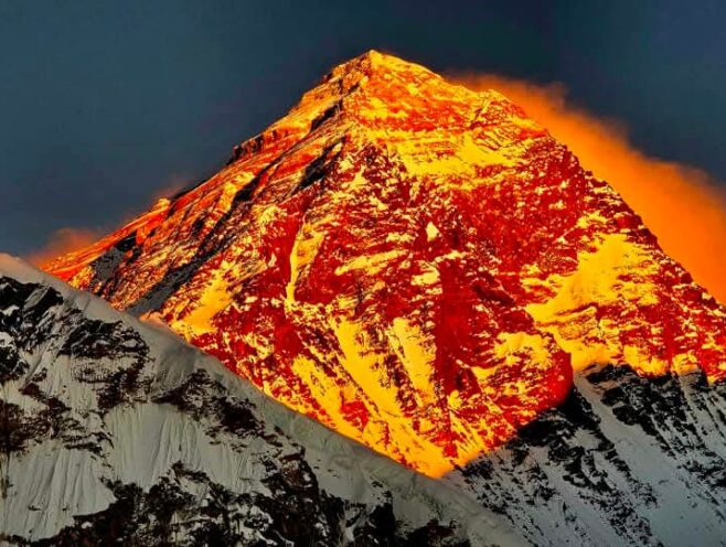
Kala Patthar is renowned for its close-up panorama of Everest, Nuptse, Pumori, and the surrounding Himalayan range.
After enjoying sunrise views, trekkers descend toward Gorak Shep and continue to a lower settlement such as Pheriche or Dingboche.
The descent is physically demanding but generally feels easier because the altitude decreases.
Day 10: Pheriche/Dingboche to Namche Bazaar
The return journey follows the Khumbu Valley. The trail passes through familiar villages and gradually loses elevation.
The air becomes thicker and vegetation begins to return as trekkers approach Namche.
- Approximate walking time: 6–7 hours
Day 11: Namche Bazaar to Lukla
The final trekking day follows the Dudh Koshi Valley back toward Lukla.
The route includes several uphill and downhill sections, so the final day still requires good stamina.
- Approximate walking time: 6–8 hours
After reaching Lukla, trekkers can celebrate completing one of the world’s most famous mountain journeys.
Day 12: Fly from Lukla to Kathmandu or Ramechhap
The final day usually involves a flight from Lukla. Flight operations in the Everest region are highly dependent on weather and visibility, so it is wise to keep some flexibility in the overall travel schedule.
For travelers with additional time, the Everest Base Camp trek can also be extended with destinations such as Gokyo Lakes, Cho La Pass, or other Khumbu viewpoints.
Everest Base Camp Trek Elevation
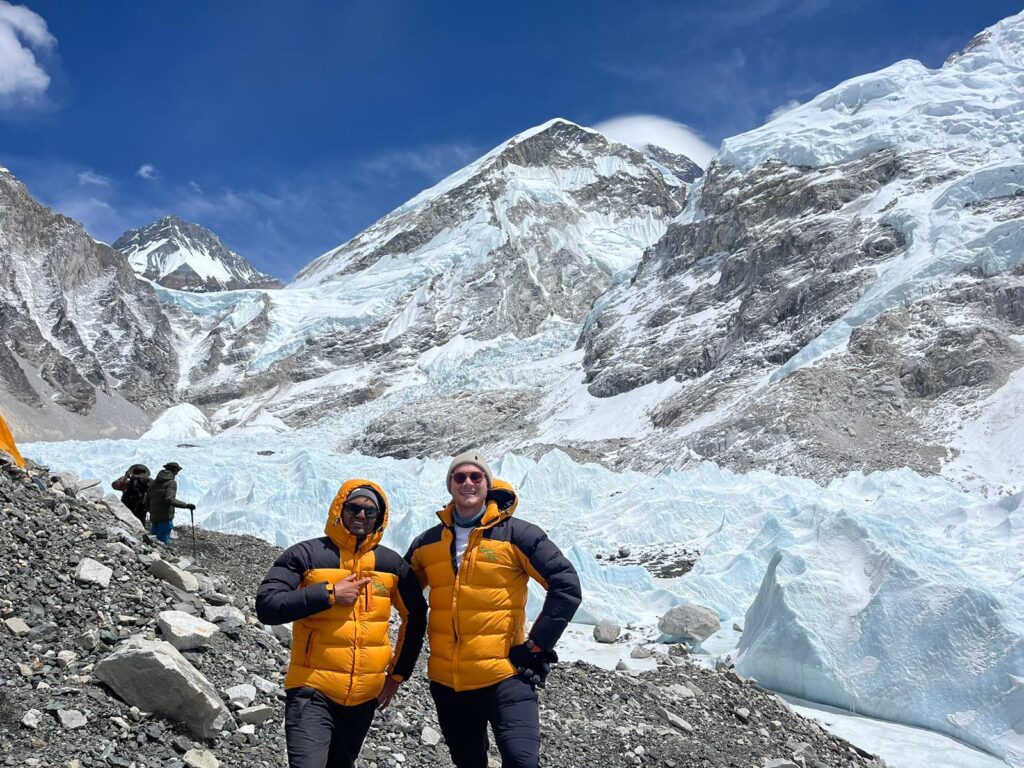
Elevation is one of the most important factors when planning an EBC trek.
The trek begins at approximately 2,860 meters at Lukla and reaches 5,364 meters at Everest Base Camp. If Kala Patthar is included, the highest point is around 5,545 meters.
The approximate elevation progression looks like this:
- Lukla – 2,860 m
- Phakding – 2,651 m
- Namche Bazaar – 3,440 m
- Tengboche – 3,860 m
- Dingboche – 4,410 m
- Lobuche – 4,940 m
- Gorak Shep – 5,164 m
- Everest Base Camp – 5,364 m
- Kala Patthar – 5,545 m
One interesting feature of the route is that elevation does not increase continuously. For example, the trail from Lukla to Phakding initially loses elevation before beginning the larger climb toward Namche.
This gradual progression is useful for acclimatization.
Why elevation matters
At higher elevations, atmospheric pressure decreases, meaning less oxygen is available with each breath. As a result, the body needs time to adapt.
Common signs of altitude-related problems can include headache, fatigue, reduced appetite, dizziness, and difficulty sleeping. Trekkers should not ignore worsening symptoms.
A well-designed itinerary therefore includes acclimatization days at Namche Bazaar and Dingboche, while allowing sufficient time for gradual ascent.
The most important rule is to avoid rushing. The Everest Base Camp trek is not a race. A slower and properly acclimatized trek is generally more enjoyable and safer.
Everest Base Camp Trek Duration
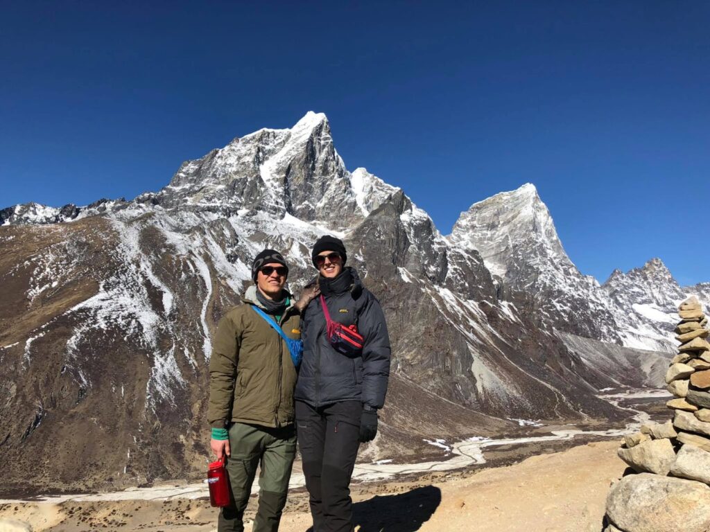
The standard Everest Base Camp trek duration is approximately 12–14 days, depending on the starting point, acclimatization schedule, transportation, and route.
A classic itinerary from Lukla to Lukla can take around 11–12 trekking days, while the complete Nepal trip may require additional days for Kathmandu sightseeing, flights, preparation, and possible weather delays.
Typical duration options
- Short EBC Trek: Around 10–11 days may be possible with a faster itinerary, but this allows less flexibility for acclimatization and is not ideal for everyone.
- Standard EBC Trek: Around 12–14 days is the most practical choice for many trekkers. It provides acclimatization time and a more comfortable walking schedule.
- Extended EBC Trek: Around 15–20+ days may be suitable for travelers who want to combine Everest Base Camp with Gokyo Lakes, Cho La Pass, additional acclimatization, or quieter side trails.
How many hours do you walk each day?
Most trekking days involve approximately 5–8 hours of walking, although the actual time depends on the route, altitude, weather, trail conditions, and individual fitness.
The distance covered each day can vary significantly. At high altitude, even a relatively short distance may take several hours because of steep terrain and reduced oxygen.
Therefore, judging the difficulty of the trek only by kilometers can be misleading. Elevation gain, terrain, weather, and acclimatization are equally important.
Can the EBC trek be extended?
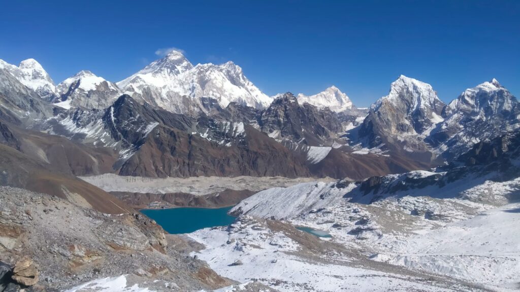
Yes. The Everest Base Camp trek can easily be extended.
Popular extensions include:
- Gokyo Lakes
- Cho La Pass
- Gokyo Valley
- Renjo La Pass
- Everest Three High Passes
- Island Peak climbing
- Additional acclimatization days
- Khumjung and Khunde villages
For travelers who want more than simply reaching Base Camp, combining EBC with Gokyo Lakes or the Three High Passes can create a longer and more adventurous Khumbu experience.
Conclusion
Understanding the Everest Base Camp trek map, elevation, and duration makes it much easier to prepare for this extraordinary Himalayan adventure. The route begins in the green hills around Lukla and gradually transforms into a high-altitude landscape dominated by glaciers, rocky mountains, and some of the world’s most famous peaks.
From Lukla at 2,860 meters to Everest Base Camp at approximately 5,364 meters, the journey requires patience, physical preparation, and proper acclimatization. The highest point is usually Kala Patthar at around 5,545 meters, if included in the itinerary.
For most travelers, a 12–14-day EBC trek provides a good balance between adventure, acclimatization, sightseeing, and rest. However, the best duration depends on your fitness level, previous high-altitude experience, preferred pace, and whether you want to add destinations such as Gokyo Lakes or the Everest Three High Passes.
A detailed route map and elevation profile should always be considered together. The map shows where you are going, while the elevation profile shows what your body will experience along the way.
With the right preparation, a sensible itinerary, experienced local support, and enough time for acclimatization, the Everest Base Camp Trek can become much more than a mountain journey—it can be a memorable experience through the heart of the Khumbu and the extraordinary landscape surrounding Mount Everest.
For travelers looking for professional local trekking support, Create Himalaya Adventure provides experienced guides, customized itineraries, trekking arrangements, and practical assistance for Everest Base Camp and other Himalayan adventures in Nepal.
Frequently Asked Questions
1. Can I fly to Lukla directly from Kathmandu for the Everest Base Camp Trek?
Yes. Flights to Lukla can operate from Kathmandu, particularly during periods when airlines are using Kathmandu as the departure point. During busy trekking seasons, flight operations may also be shifted to Ramechhap/Manthali Airport because of air-traffic congestion at Kathmandu. Your trekking company normally confirms the departure airport according to the current flight schedule and operational conditions.
2. Why do some Everest trekkers fly from Ramechhap instead of Kathmandu?
Ramechhap Airport, also known as Manthali Airport, is sometimes used for Lukla flights during the peak trekking seasons. The airport is located outside Kathmandu, so trekkers need to travel by road from Kathmandu to Ramechhap, usually very early in the morning. Although this adds a road journey, it can help avoid congestion at Kathmandu’s main airport and maintain the Lukla flight schedule.
3. How does the Everest trail change as the elevation increases?
The trail changes dramatically with altitude. Lower sections around Lukla and Phakding have forests, farmland, rivers, and green hills. Around Namche, the landscape becomes more mountainous. Above Dingboche, vegetation becomes sparse, while the trail toward Lobuche and Gorak Shep is dominated by rocky terrain, glaciers, and high Himalayan landscapes. The higher you climb, the colder, drier, and more rugged the trail generally becomes.
4. Is the Everest Base Camp trail difficult because of the distance or elevation?
Both contribute, but elevation is usually the bigger challenge. Some trekking days are not exceptionally long in terms of distance, yet walking above 4,500 meters can feel considerably harder because of reduced oxygen. Steep sections, rocky paths, changing weather, and repeated ascents and descents also add to the physical challenge.
5. Does the price of an Everest Base Camp Trek increase as the altitude increases?
Not necessarily in a simple day-by-day way, but operating costs generally rise at higher elevations. Food, fuel, accommodation, staff supplies, and transportation of goods become more expensive because everything has to be carried or transported farther into the mountains. This is one reason meals and rooms in places such as Gorak Shep can cost considerably more than similar services in Kathmandu or lower Khumbu villages.
6. Can I stay in a luxury room during the Everest Base Camp Trek?
Luxury accommodation is available in some lower and mid-altitude villages, especially around Lukla and Namche Bazaar, where some lodges offer better rooms, private bathrooms, heating, and upgraded facilities. However, accommodation becomes much more basic as you approach Everest Base Camp. At high-altitude settlements such as Lobuche and Gorak Shep, trekkers should prioritize warmth, cleanliness, location, and availability rather than expect city-style luxury.
7. Is Wi-Fi and mobile network available throughout the Everest Base Camp route?
Network and internet facilities are available in many parts of the Everest region, but coverage is not continuous. Mobile networks and Wi-Fi are generally easier to access in larger settlements such as Namche Bazaar. Connectivity can become weaker or less reliable at higher elevations. Some lodges provide paid Wi-Fi, while mobile data may work in certain locations depending on the network, weather, and local infrastructure.
8. Can I use my mobile phone at Everest Base Camp?
You may be able to use a mobile phone around Everest Base Camp, but connectivity should not be considered guaranteed. Network availability can change according to location and conditions. It is best to download important maps, trekking information, emergency contacts, and entertainment before leaving Kathmandu because offline preparation is useful when internet service becomes unreliable.
9. Is Kala Patthar worth adding to an Everest Base Camp itinerary?
Yes. Kala Patthar is one of the most valuable additions to the classic EBC route for travelers who want spectacular views of Mount Everest. Although Everest Base Camp itself is the primary destination, Kala Patthar provides a more open and impressive mountain panorama, including views toward Everest, Nuptse, Pumori, and surrounding peaks.
10. Is sunrise or sunset better from Kala Patthar?
Sunrise is generally considered better than sunset from Kala Patthar. Early morning often provides clearer mountain visibility, and the first sunlight gradually illuminates Everest and the surrounding peaks. The early start can be cold and demanding, but the changing colors across the Himalayan skyline can make the experience unforgettable. Sunset can also be beautiful, but evening clouds and decreasing visibility can sometimes reduce the quality of the views.
11. Do I have to return to Kala Patthar after reaching Everest Base Camp?
No. Kala Patthar and Everest Base Camp are separate destinations, although they are normally combined in the same itinerary. Many trekkers visit Everest Base Camp first and climb Kala Patthar the following morning. This arrangement allows them to enjoy Base Camp without rushing and then experience the sunrise from the viewpoint.
12. Can I cross Kongma La Pass during an Everest Base Camp Trek?
Yes. Trekkers with sufficient time, good physical preparation, suitable weather, and appropriate guidance can add Kongma La Pass to their Everest itinerary. At approximately 5,535 meters, it is a demanding high-altitude crossing and should not be treated as an ordinary trekking day. It usually requires additional planning, acclimatization, and favorable trail conditions.
13. Can I cross Cho La Pass instead of taking the normal Everest Base Camp route?
Yes. Cho La Pass can be incorporated into an extended Everest itinerary, particularly when combining the EBC trek with the Gokyo Valley. The pass involves steep and challenging terrain and can be affected by snow and ice. Trekkers should allow extra days and avoid attempting the crossing without adequate preparation and experienced local guidance.
14. Which is better for an EBC extension: Kongma La or Cho La?
It depends on your trekking objective. Kongma La is a challenging option for trekkers seeking a more demanding high-pass experience on the Everest side of the valley. Cho La is particularly attractive if you want to combine Everest Base Camp with Gokyo Lakes. Both are demanding, so the choice should consider acclimatization, weather, fitness, and available time rather than simply which pass is higher or more famous.
15. Can I see Mount Everest clearly from Everest Base Camp itself?
Everest Base Camp is an extraordinary destination, but the best unobstructed views of Everest are not necessarily from Base Camp. The Khumbu Glacier and surrounding terrain can limit the direct view. Kala Patthar is famous because it provides a much more open perspective toward Everest and the surrounding Himalayan peaks.
16. How much does the Everest Base Camp trek cost at different elevations?
The overall cost depends on accommodation, meals, guide and porter services, permits, transportation, and personal spending. In general, daily expenses become higher as the trail climbs because supplies are more difficult and expensive to transport. A cup of tea, meal, Wi-Fi service, or room at Gorak Shep may therefore cost more than the equivalent service in Namche Bazaar.
17. Are the trails to Everest Base Camp open during every trekking season?
The route is not equally accessible throughout the year. Winter can bring heavy snow and freezing temperatures, while monsoon weather can cause rain, slippery trails, landslides in lower areas, and flight disruptions. Spring and autumn are generally the most popular trekking periods because of favorable weather and visibility, although conditions can still change rapidly in the mountains.
18. How do weather conditions affect the Everest Base Camp Trek duration?
Mountain weather can directly affect the schedule. Lukla flights may be delayed or cancelled because of poor visibility or unfavorable weather, while snow, heavy rain, or difficult trail conditions can slow trekking progress. For this reason, it is wise to keep at least one or two flexible days in your broader Nepal travel schedule rather than planning an international flight immediately after returning from Lukla.
19. Can I shorten the Everest Base Camp Trek by using a helicopter?
Yes. Helicopter services can be used for certain sections of the journey, depending on weather, availability, regulations, and budget. Some travelers use helicopters to return from the Everest region after reaching Base Camp or to shorten part of the itinerary. However, trekking the complete route provides a much deeper experience of the villages, landscapes, culture, and gradual change in elevation.
20. What is the best way to prepare for the changing elevation on the EBC trail?
The best preparation combines physical fitness, gradual acclimatization, hydration, sensible pacing, and adequate rest. Training should include long walks, uphill hiking, stairs, and endurance activities before the trip. Once in the Khumbu, avoid rushing to higher elevations and pay attention to how your body feels. A carefully planned itinerary is more important than trying to complete the trek as quickly as possible.
21. Can beginners complete the Everest Base Camp Trek without previous high-altitude trekking experience?
Yes, many first-time Himalayan trekkers successfully complete EBC. Previous high-altitude experience is helpful but not essential. The key factors are reasonable fitness, proper acclimatization, preparation, patience, and responsible trekking. Beginners should choose an itinerary that provides enough time rather than selecting an extremely short schedule simply to reduce the number of trekking days.
22. How far in advance should I plan an Everest Base Camp Trek?
It is advisable to begin planning several months before your preferred trekking season, especially if you want specific flights, experienced guides, better accommodation, or a customized itinerary. Early planning also gives you enough time to prepare physically, organize equipment, arrange permits, and allow flexibility for international and domestic travel.
23. Can I get hot showers and charging facilities on the Everest Base Camp route?
Hot showers and charging facilities are available at many teahouses, particularly in lower villages, but they usually come at an additional cost. Facilities become more limited and expensive at higher elevations. Electricity and charging availability can also depend on local power supply and lodge facilities, so carrying a power bank is a practical backup.
24. Is a trekking map or GPS necessary for the Everest Base Camp route?
The main EBC trail is well established and frequently trekked, so a professional guide can normally navigate the route without relying solely on GPS. Nevertheless, carrying an offline trekking map or GPS-enabled phone is useful for checking your location, distance, elevation, and upcoming villages. It is especially valuable if you take alternative routes such as Kongma La, Cho La, or Gokyo.
25. Why is the Everest Base Camp Trek longer than the actual distance might suggest?
Because the trek is designed around acclimatization rather than simply covering kilometers. The body needs time to adjust as the elevation rises from Lukla to more than 5,000 meters. Rest and acclimatization days may therefore make the itinerary longer, but they provide a much more sensible approach to high-altitude trekking. The goal is not merely to reach Everest Base Camp quickly—it is to reach it safely and enjoy the journey along the way.
26. Can I customize the Everest Base Camp Trek duration according to my fitness level?
Yes. An experienced local trekking company can customize the itinerary by adding acclimatization days, shorter walking stages, side trips, or high-pass sections. Trekkers who prefer a relaxed journey can take more time, while experienced hikers may choose a more challenging itinerary. However, shortening the trek should never come at the expense of proper acclimatization.
27. What makes the Everest Base Camp trek route different from other Nepal trekking routes?
The EBC route combines extraordinary mountain scenery with Sherpa culture, Buddhist monasteries, high-altitude settlements, suspension bridges, glacial landscapes, and access to the world’s highest mountain. Few trekking routes provide such a dramatic transition from green valleys to an extreme Himalayan environment within one journey.
28. Should I choose a standard EBC route or add a high pass?
Choose the standard route if your primary goal is to reach Everest Base Camp comfortably and enjoy the classic Khumbu experience. Consider adding Kongma La or Cho La if you have additional days, good acclimatization, suitable fitness, and a desire for a more challenging adventure. High passes should be treated as optional adventures rather than compulsory parts of an EBC trek.
29. What should I do if the trail becomes difficult because of snow or ice?
Do not rush. Follow your guide’s assessment, use appropriate footwear and trekking poles, and allow extra time when necessary. High-pass routes are particularly sensitive to snow and ice. If conditions become unsafe, changing the itinerary or waiting for better conditions is a better decision than taking unnecessary risks.
30. Is the Everest Base Camp Trek better with a local trekking company?
A reputable local trekking company can simplify transportation, permits, accommodation, guides, and itinerary management while providing support when weather or trail conditions change. Create Himalaya Adventure offers experienced local guides and customized trekking arrangements for travelers planning Everest Base Camp and other Himalayan journeys in Nepal.
Ramchandra Lamichhane
Trekking Expert
No hidden fees • Local experts • Best price guarantee